

3D Mobile Mapping - Rail Road
PROJECTS
3D Mobile Mapping - Rail Road
Objective:
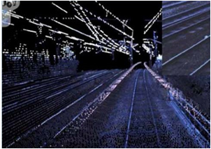
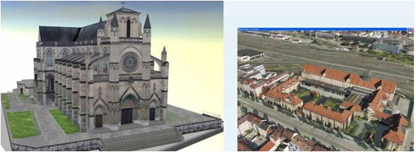
Station Buildings, Houses, Over Passes, Tunnels contained in the area cover by the aerial scanning and seen from the viewpoint of the simulation are modeled and Textured in 3D using 3Ds max software. The process starts with capturing the footprints of 3d_Objects.
Inputs Used :
3D_Objects foot prints, video, cpv images and rail centreline.
Output :
3D Models.
Final data quality will be checked and validated using 3D-Engine