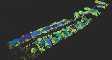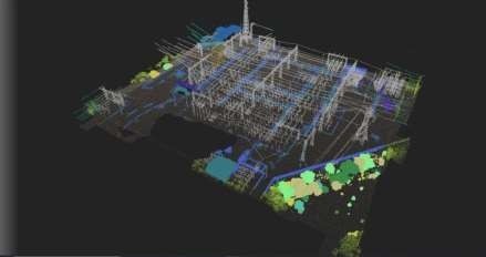

Powerline Classification
PROJECTS
Powerline Classification
TRANSMISSION AND DISTRIBUTION NETWORK:
This project was executed on a proprietary Software that automates Lidar point Cloud classification and 3D modelling through smart algorithms. Terrain, poles, conductors, vegetation and manmade objects are automatically classified and modelled. All the data including point cloud, models and reports are accessed and viewed / Edited via the web-based user interface., The data will be quality checked and updated as needed to edit the 3D model to reflect the details in the point cloud. The goal of the quality check and editing is to confirm that all features are visually correct and attributed. This workflow can be completed in any order